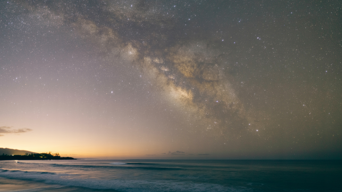
Standing on Sunset Beach after the crowds have gone, you're looking at the same night sky that guided Hawaiian navigators across thousands of miles of open ocean. The stars above Oahu's North Shore aren't just beautiful—they're a map. For centuries, Polynesian navigation star compass techniques allowed voyagers to traverse the Pacific using only celestial knowledge, wave patterns, and an intimate understanding of the ocean.
These Hawaiian wayfinding traditions, nearly lost to history, experienced a powerful revival in 1976 when the voyaging canoe Hōkūleʻa sailed to Tahiti using traditional methods. Today, that living knowledge continues through the dedication of master navigators who've spent decades relearning what their ancestors knew by heart.
Wayfinding is different from navigation. Navigation implies instruments, charts, technology. Wayfinding is relationship—with stars, swells, birds, clouds. It's a way of being in conversation with the natural world, of reading signs so subtle they disappear under artificial light. And here on the North Shore, where the ocean has always been teacher, the stars still shine bright enough to remember.
Nainoa Thompson and the Revival of Polynesian Wayfinding
In 1976, when Hōkūleʻa set sail from Hawaiʻi to Tahiti, she carried more than a crew. She carried a question that had haunted Hawaiians for generations: How did our ancestors cross this ocean without instruments?
For over a century, traditional wayfinding knowledge had been dormant. Colonization, the decline of voyaging canoes, and the introduction of Western navigation methods meant that by the mid-20th century, no Hawaiian navigator alive could guide a canoe by stars alone. The knowledge wasn't entirely lost—elders still told stories—but the practice, the lived experience of reading the ocean and sky, had faded like star light at dawn.
Then came Mau Piailug.
A master navigator from the island of Satawal in Micronesia, Mau was one of the last people on Earth who could still wayfind using traditional methods. In the early 1970s, members of the Polynesian Voyaging Society sought him out, hoping he would teach a young Hawaiian sailor named Nainoa Thompson the ancient art.
The apprenticeship was rigorous. Mau didn't hand Nainoa charts or diagrams. He taught the way his grandfather had taught him—through observation, repetition, and deep attention. They spent hours lying on the deck of Hōkūleʻa, watching stars rise and set, memorizing their positions, learning to read the relationship between sky and horizon. "You cannot navigate if you cannot see the stars," Mau would say. "But more importantly, you cannot navigate if you do not know how to look."
"Wayfinding is no longer a lost art. It's a living tradition, practiced and perpetuated, linking contemporary Hawaiians to thousands of years of ocean knowledge."
In 1980, Nainoa Thompson became the first Hawaiian in modern history to successfully navigate a voyage from Hawaiʻi to Tahiti using only traditional wayfinding. No compass. No sextant. No GPS. Just stars, ocean swells, and a mental map passed down through generations.
Today, the Polynesian Voyaging Society continues this work. Hōkūleʻa has sailed over 150,000 nautical miles, training new generations of navigators. The canoe that once asked "how did our ancestors do this?" now teaches the answer through lived practice. Wayfinding is no longer a lost art. It's a living tradition, practiced and perpetuated, linking contemporary Hawaiians to thousands of years of ocean knowledge.
The Star Compass: A Mental Map of the Horizon
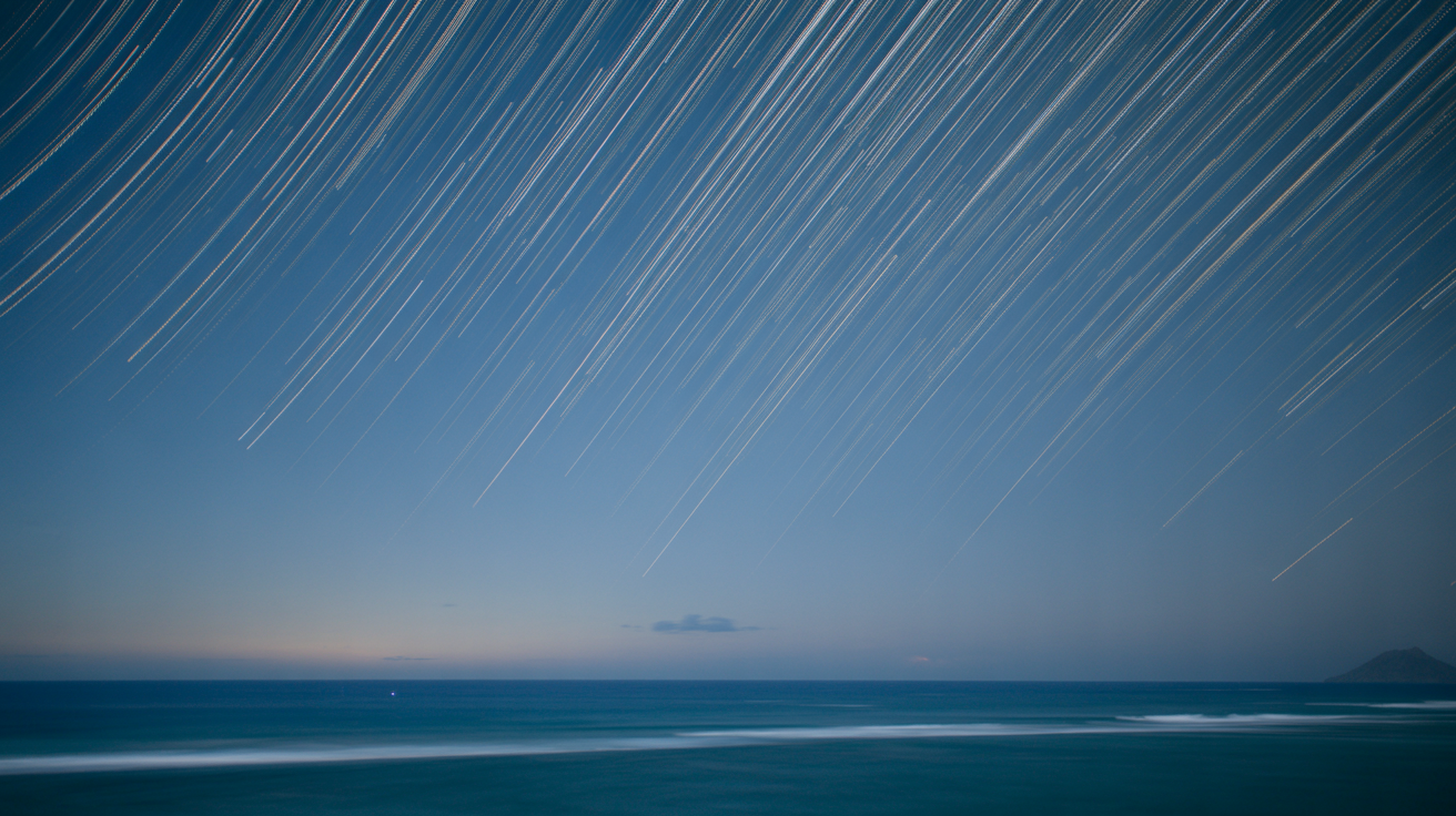
Imagine standing on a beach at night, the horizon forming a perfect circle around you. The ocean stretches in every direction, featureless in the darkness. But above, the stars are rising and setting with absolute predictability, tracing the same paths night after night, season after season.
Now divide that horizon circle into 32 equal sections—32 "houses" where specific stars rise and set. This is the foundation of the Hawaiian star compass: not a physical tool you hold in your hands, but a mental map you carry in your mind. No instruments. No charts. Just memory, observation, and the stars themselves.
The star compass transforms the seemingly chaotic night sky into a navigation system. Each of the 32 houses marks an 11.25-degree segment of the 360-degree horizon. Navigators memorize which stars rise and set in which houses. When you know a star's house, you know its bearing. When you can track multiple stars across the night, you can maintain course even as individual stars move across the sky.
Unlike a Western compass with its fixed cardinal points, the star compass is alive. It moves with the turning Earth. Stars that rise in the east at sunset will arc overhead and set in the west by dawn. But their rising and setting points—their houses on the horizon—remain constant. A star that rises 11.25 degrees north of east tonight will rise in that same position tomorrow, next month, next year.
This consistency is what makes wayfinding possible. Ancient Polynesian navigators didn't need to understand the physics of Earth's rotation or the precise astronomical reasons why stars behave as they do. They needed only to observe, remember, and trust the patterns.
On the North Shore, where light pollution from Honolulu hasn't yet swallowed the darkness, you can still see what navigators saw. The Big Dipper. The Southern Cross. Orion's Belt. These aren't just constellations—they're guideposts, reference points in houses on the horizon, tools for finding your way home.
Understanding the Hawaiian Star Lines (Ke Ala Loa O Ke Ao)
The Hawaiian name for the star compass paths is Ke Ala Loa O Ke Ao—the long road of daylight, or the path of deep ocean. The name itself teaches: these aren't shortcuts or tricks. They're roads, well-traveled routes that generations of navigators have followed across the Pacific.
Wayfinding relies on knowing not just where stars are, but where they're going. A star rises in the east, climbs across the sky, and sets in the west. But the specific point where it rises—its "house"—depends on the time of year and the star itself. Some stars, like those near the celestial equator, rise almost due east. Others rise northeast or southeast, creating a network of reference lines across the sky.
Navigators learned these star lines the way you might learn roads in your neighborhood. If you want to go north, you follow this star as it rises. To go southwest, you track that constellation as it sets. The paths aren't straight—you adjust course as stars move across the sky, shifting your reference from one star to the next as they rise and set throughout the night.
Layered on top of star knowledge was an understanding of ocean swells, bird flight patterns, cloud formations, and water color. Hawaiian navigators didn't rely solely on stars. They read the entire environment as an interconnected system. Swells refract around islands, creating patterns that can be felt through the hull of a canoe hundreds of miles before land becomes visible. Certain seabirds only fly within specific distances from shore. Clouds form differently over land than over open ocean.
This holistic approach meant that even during the day, or on overcast nights when stars weren't visible, navigators could maintain course. The ocean was never featureless. It was full of information, written in languages they'd spent lifetimes learning to read.
On the North Shore, you can feel some of this still. The way swell lines stack up against the reef. The way wind shifts as you move along the coast. The ocean is still speaking. We've mostly just forgotten how to listen.
The 32 Houses of the Star Compass
The 32 houses of the star compass are organized around four cardinal directions, each with its own Hawaiian name rooted in place and environment. Ko'olau marks the northeast—the direction of Oʻahu's windward Ko'olau mountain range. Kona indicates southwest—the leeward side where winds are calmer. Malanai points southeast, and Ho'olua northwest.
From these four primary directions, navigators divided the horizon into increasingly precise segments. Four directions became eight, eight became sixteen, and finally sixteen became thirty-two. Each division creates a house with a name, often describing wind patterns, weather, or stars associated with that bearing.
The system isn't abstract geometry. It's embodied knowledge built from observation. Navigators didn't calculate angles—they felt them. They knew a star's house not because they'd measured 11.25 degrees, but because they'd watched that star rise in that place hundreds of times, in different seasons, in different ocean swells, until the position became as familiar as the slope of their own hands.
Within each house, certain stars served as primary references. Hōkūleʻa (Arcturus), the star for which the famous voyaging canoe is named, rises and sets in specific houses depending on the season. The Southern Cross, invisible from most of the continental United States but clearly visible from Hawaiʻi, marks southern directions. Navigators might track ten or fifteen key stars throughout the night, shifting from one to another as they moved across the sky, maintaining course through constant adjustment.
This is where wayfinding becomes meditation. You can't think your way through it. You have to be present, attentive, in relationship with the sky and ocean. One master navigator described it as "sailing by feeling"—not emotion, but somatic awareness, a deep bodily knowing that emerges only after thousands of hours under stars.
The 32 houses aren't a formula. They're a framework for attention, a way of organizing knowledge that honors both precision and relationship.
Learning to Read the Night Sky on the North Shore
The North Shore offers something increasingly rare: dark skies. While Honolulu's glow dominates the southern horizon, heading north along Kamehameha Highway reveals more stars with each passing mile. By the time you reach Sunset Beach or Mokulēʻia, the Milky Way becomes visible on moonless nights—a river of light across the sky.
The best time for stargazing here is between midnight and dawn, particularly during new moon phases when the sky is darkest. Winter months bring clearer skies, though summer offers warmer nights for those willing to wait. Bring a blanket, find a beach away from streetlights, and give your eyes 20 minutes to fully adjust. You'll be surprised how many stars emerge from what first appears as simple darkness.
From Oʻahu at 21°N latitude, you can see both northern constellations like Ursa Major (the Big Dipper) and southern stars like the Southern Cross, which hangs low on the southern horizon during spring. Orion dominates winter skies, while Scorpius marks summer evenings. These are some of the same stars Hawaiian navigators used—not as mythological figures, but as practical guideposts.
You don't need to be able to navigate by stars to appreciate them. Just lying under the night sky, away from screens and artificial light, reconnects us to something ancient. The stars haven't changed. We have. We've filled our nights with so much brightness that we've forgotten how to see what's always been there.
The North Shore invites us to remember. Not to become navigators—that requires years of dedicated training—but to look up and recognize that the sky is still teaching, still guiding, still mapping paths across the ocean for anyone willing to learn its language.
Where to See Stars Today: Best Spots and Resources
For dark sky viewing on the North Shore, head to beaches beyond the main town lights. Mokulēʻia Beach, past Haleʻiwa on the west side, offers excellent stargazing with minimal light interference. Turtle Bay Resort area, while developed, has dark stretches of beach between streetlights. Sunset Beach and Pūpūkea can work well, though you'll want to position yourself away from road lights.
If you're interested in learning more about traditional wayfinding, the Polynesian Voyaging Society occasionally offers public programs and educational opportunities. When Hōkūleʻa is in port, tours may be available, though schedules vary based on the canoe's voyaging calendar. Check their website for current information.
The Bishop Museum in Honolulu has permanent exhibits on Hawaiian navigation and hosts planetarium shows that explore traditional wayfinding techniques. Their programs connect ancestral knowledge with contemporary astronomy, showing how navigators understood the sky without modern instruments.
Several books offer deeper understanding: Hawaiki Rising by Sam Low documents the renaissance of traditional voyaging. Nainoa Thompson's essays and interviews, available through the Polynesian Voyaging Society's website, provide first-person accounts of learning wayfinding from Mau Piailug.
Local astronomy clubs occasionally hold stargazing events on Oʻahu. These aren't specifically focused on traditional navigation, but they can help you learn to identify stars and constellations that navigators used.
The important thing: this knowledge is accessible. You don't need permission to look up. The stars are still there, still teaching. All that's required is darkness, time, and attention.
Connecting Navigation to Modern Surf Culture
There's a thread running between traditional wayfinding and modern surf culture, subtle but undeniable. Both require reading the ocean. Both demand attention to patterns invisible to casual observers. Both trust intuition built from countless hours of observation.
Surfers talk about reading swells the way navigators talk about reading star paths. You learn to see swell direction, period, energy. You learn which reefs light up under which conditions. You develop a somatic knowledge—a felt sense—of how the ocean moves.
Many North Shore surfers carry this awareness beyond the break. Just as the North Shore artist collective draws inspiration from traditional patterns and ocean rhythms, contemporary watermen and waterwomen continue practices rooted in deep observation. They track moon phases, wind shifts, seasonal changes. They learn the names of places and understand why those names matter.
Like identifying traditional Hawaiian medicinal plants requires attention to subtle differences in leaf shape and growing patterns, wayfinding requires noticing details others miss. These skills share a common foundation: mālama ʻāina, caring for land and ocean by being in relationship with them.
You don't have to navigate by stars to practice wayfinding's deeper lesson—pay attention. Watch. Listen. Notice patterns. Trust that the natural world is constantly communicating, and that we're capable of learning its language.
The same stars that guided double-hulled canoes across the Pacific still rise above Sunset Beach every night. We can choose to see them.